
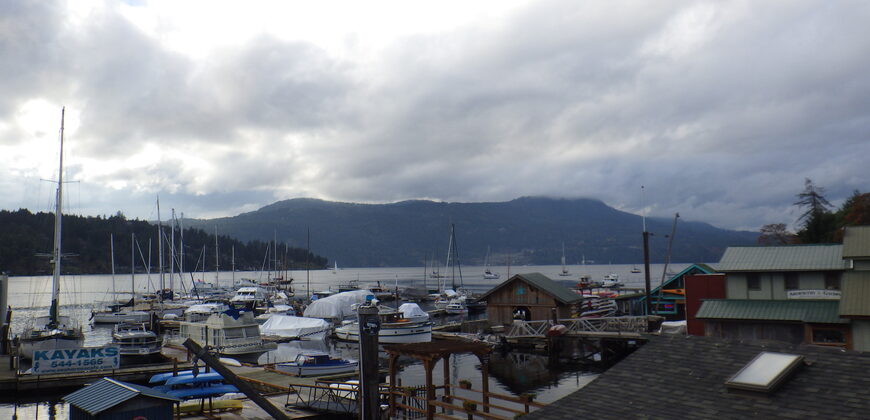
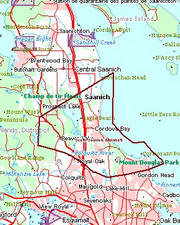
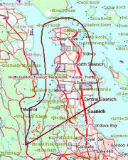
Welcome To Saanichton
A beautiful little Village in the heart of Central Saanich.
Find out what is happening, when and where to catch a bus, Real Estate connections, see a map of the area, read a little history and much more.
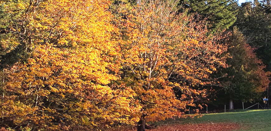


How to Start a Butterfly Garden
It's that time of year again - Gardens and beautiful butterflies
How to Start a Butterfly Garden
September 29, 2019 by Brooke Wohlrabe
Butterflies are admired for their bright colors and graceful movements. Butterflies are not just attractive insects, but they can help pollinate plants. If you’d like to see more butterflies around your yard, you should consider starting a butterfly garden.
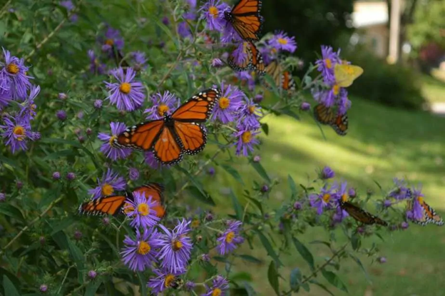
Several Monarch butterflies are seen on some Aster Woods Purple flowers.
A butterfly garden does not just attract butterflies to your garden, but truly helps butterflies because it gives them a safe space and ample plants and flowers to feed on and lay eggs on.
Great opportunity for your hockey players

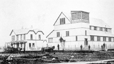
West Saanich School
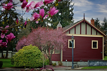
1880 saw the West Saanich School being built as the first school in Brentwood Bay. This one room school was built on land donated by John Slugget and George Stelly.

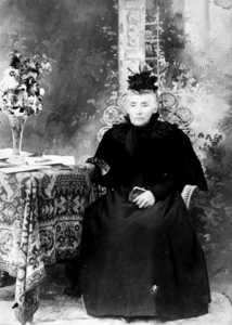
George Stelly Slugget Farm 1880's Mrs. John Slugget
It was a cute little one-room school that taught all the children in Brentwood Bay and the surrounding area. During 1909 a new school was contracted to serve the ever expanding population. It was active from 1909 to 1952 and continually used it’s pot belly stove for heating and the proverbial outhouse for facilities. Students came from as far away as Mt. Newton to Prospect Lake to gain their education.
Many upgrades and improvements have been made and the community uses it for many group meetings and youth organizations. Girl Guides and Boy Scouts have proudly flown their flags since the 1960’s.
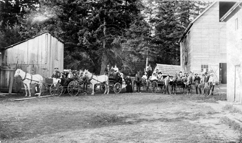
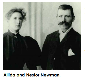
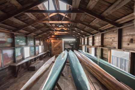
Newman Farm and Boat Shed
Newman Farm and Boat Shed Park
A secret that has been around since 1880. A family held farm for over 100 years The Newman’s ,Allida and Nestor, bought the parcel in the 1880’s. Nestor, a Finlander, worked at the Dunsmuir coal mines built the original cabin which is still standing today. They built a larger newer home in 1905 to house their seven sons and two daughters. Nestor passed away in 1913 leaving Allida to raise the family and seeing that they were self-reliant they grew their own food, fruits, and cattle. The farm was worked until 1996. Although small, they were mighty, raising prize winning jersey cattle. The Newman’s donated the farm and property to the district of Central Saanich in 2003. Everything that you will see there is completely authentic. The brothers did not want any new-fangled conveniences so they chose not to have electricity or plumbing.
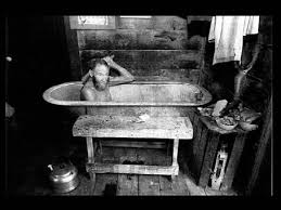
John Newman Bathing
Although the property was purchased by Newman, it is very likely that this area was historically important to the Tsawout First Nations who hold an exclusive traditional claim to the area. The Tsawout are part of the Saanich Peoples. Prior to 1850, the Saanich occupied three main villages on the Saanich Peninsula – one of which was situated in Saanichton Bay - as well as other settlements in the Gulf Islands. Prior to the coming of Europeans in the late 18th Century it was observed that, "At one time or another practically every sheltered bay and nook along the southeast coast of Vancouver Island, and on the small islands adjacent to it, carried a settlement of greater or less size…”
Central Saanich and The Farmlands Trust joined together in 2012 to have the 6.6 hectare grow an assortment of fruits and vegetable for use by food banks and Our Place. In addition to this, a local farmer developed a program that involves local schools in a sheep farm.
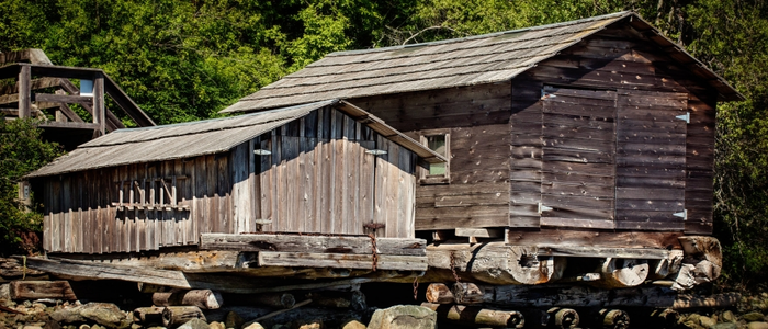
The community has rallied around and volunteered to maintain, farm, and help others with the historic Newman Farm. In fact they restored two barns to use as boat houses from which the Tsawout Nation canoe Club store their racing boats. At this time you cannot go into the buildings but being able to go and explore the grounds and area gives you a rare glimpse into days gone by. The kids will enjoy running around an exploring the artifacts scattered around.
It is really easy to find. Turn towards the ocean on Mt. Newton X Rd. and then turn left on Lochside Rd. till you come to Newman Rd., you will see the Farmlands Trust signs on the lawn and you will know you have arrived. It truly is a wonderful glimpse into our past and how it brings out the best out in us today. The guiding Vision of the District of Central Saanich Master plan for the Newman Farm is coming to life.
“The community of Central Saanich will care for Newman Farm in a manner that honours the legacy of the Newman Family, reveals our agrarian heritage, demonstrates our values, and involves and considers our community.”
Photo credts: Chuck Groot and Bob Coates
Island View Beach
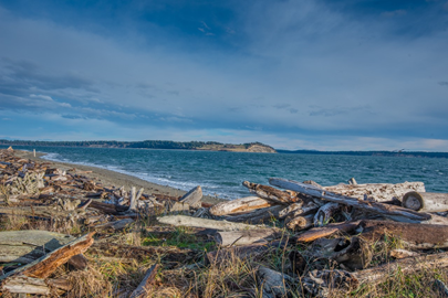
A gem in Central Saanich! Island View Beach provides long rocky and sandy beaches for your pleasure. With the bonus of there not usually being a lot of people. A fantastic place to commune with nature and get your dose of positive ions. Photos, there are photo ops everywhere you look, especially when Mt. Baker is out showing its glorious snow crested peak. And, lots of parking. Scattered about are a few display boards with local information to learn a little more about the area.
The park borders the Tsawout Nation and the area is of great cultural and spiritual significance to them. Conservation and protection of the wetlands and fragile grass and tree species are of great importance to all. Of particular importance is the bird area, it is a vital breeding ground for a variety of species.
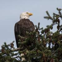
Ahh the views. Did I mention the views here? It is exquisitely spacious, beach, grassland, sunrise, sunset, star gazing, and full moons to drink in. The park is kept wonderfully clean, with the exception lazy dog owners. Look to the north and you see the Hope range, to the south we have the Olympic range and to the east Mount Baker. Often you will see the eagles fly overhead or the deer playing in the fields. And just a stone’s throw away from the beach, you can see Darcy Island, James Island, and Sidney Island. The official name of the body of water your are looking at is the Haro Strait.
Your dog(s) will love it, it is dog friendly! There are many areas for them to roam on and off the leash. They must be on the leash from May to September. With paths throughout the area to enjoy rambling and of course just walking on the beach. You will also find your share of pooches frolicking in the water.
For the agile there are plenty of interesting clumps of driftwood to play on. You can jog the paths for those looking for cardio exercise. Fantastic spot for wind and kite surfing. Easy access to launch you kayak or canoe as well.

Your kids will never get bored here. Play in the sand, swim in the ocean, explore, fly kites, or just lay in the sun with them. Logs and branches abound making it easy for the children to make forts and castles. Naturally there are the requisite cool rocks and shells to discover. You might even find the occasional fossil as well. A night you can come out and view the stars with them and enjoy the falling stars. It is wonderful that there are no city lights to interfere with night time gazing. A great place for the family.
There are picnic tables and restrooms close by for your convenience. It is also equipped with a group fire ring and drinking water station.
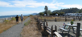
It is also so easy to find; drive down the Pay Bay Hwy. and turn East on Island View Rd.; you will know you are the right place when you see Michell’s Farms. Drive for about 3 km and before you know it, you will be at the beach. The campground is open from the Victoria Day long weekend in May and closes on the Labour day long weekend in September. For your convenience they have online reservations at crdregionalparks.perfectmind.com .
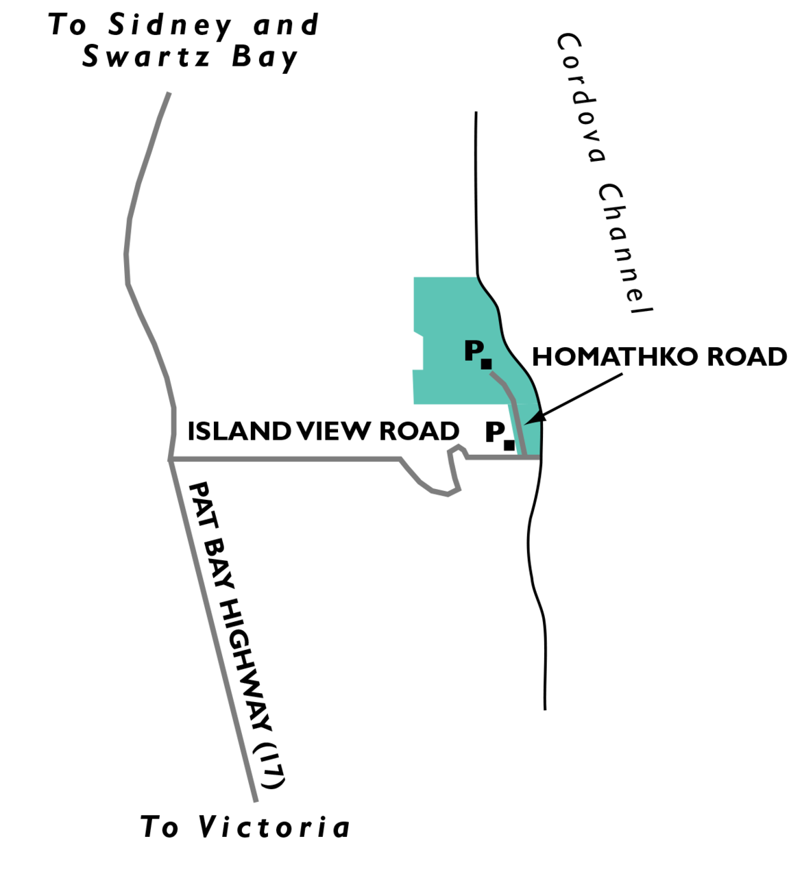
Photo Credits: Chuck Groot and Bob Coates
Black Pioneers in British Columbia
Les Pionniers Noirs de la Colombie-Britannique
Their loss our gain.
1850’s saw many discriminatory laws being passed in the United States and specifically in California where they discouraged blacks from entering or staying in the state. Among other horrid laws; they were required to wear distinctive badges.
Sir James Douglas, governor of British Columbia, whose mother was an African Creole mother and a European father, spoke to a group of Blacks who came up from California and promised them equality and opportunity. A group of almost 800 Black Americans came up and settled primarily on lower Vancouver Island and Salt Spring Island. These families made a huge difference in the lives of British Columbians.
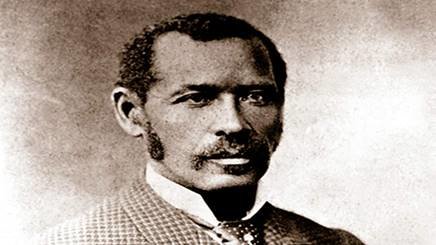
Mifflin Gibbs was one of the men who led the entourage to British Columbia. He became a naturalized British citizen in 1861. He had many different jobs, owned companies and was involved in politics; including being an alderman on Victoria City council. 10 years later he moved back to the states and was elected a judge among other professions.
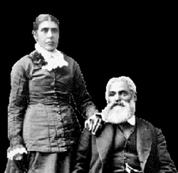
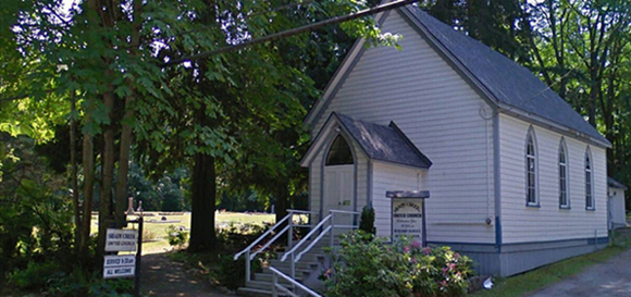
Charles Alexander and his wife Nancy came to Victoria in 1958. He made his original home on a site later occupied by the Hudson’s Bay Company. This is back when Victoria was a tent city.
Charles was an accomplished orator which he used to great advantage as a teacher and preacher. He built the first school in South Saanich and became a trustee. As well, he initiated the building of Shady Creek Church, and he assisted building it in 1862.
Governor Douglas was concerned by the influx of Americans, the Americans might retaliate for losing their slaves. The thought that because of American slavery, African Americans could be counted on to resist an American takeover and it worked. The new settlers showed their appreciation by establishing the Victoria Pioneer Rifle company to protect their new home and friends.
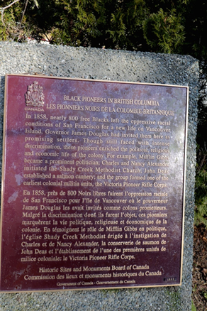
In appreciation for what they did for us, a marker was erected in Central Saanich in 1999 by Historic Sites and Monuments Board of Canada near 7180 East Saanich Road, Central Saanich, British Columbia V8M 1Y4, Canada. On it is inscribed:
“In 1858, nearly 800 free Blacks left the oppressive racial conditions of San Francisco for a new life on Vancouver Island. Governor James Douglas had invited them here as promising settlers. Though still faced with intense discrimination, these pioneers enriched the political, religious and economic life of the colony. For example, Mifflin Gibbs became a prominent politician; Charles and Nancy Alexander initiated the Shady Creek Methodist Church;
Tsartlip First Nations

All part of the Saanich Nation of Coast Salish peoples, the Songhees, Esquimalt, Tsartlip, Tseycum, Pauquachin, Scia'new, Tsawout and T'Sou-ke Nations are all important bands that have long called Southeastern Vancouver Island home.
The Tsartlip First Nation is a First Nation located on the Saanich Peninsula, in Saanich territory on Vancouver Island. They are a member of the Sencot'en Alliance fighting for Native rights.[1] In the 1850s they were signatories to one of the Douglas Treaties.[2]
W̱JOȽEȽP (Tsartlip) is part of the W̱SÁNEĆ (Saanich) First Nation with territory centered on the Saanich Peninsula and southern Gulf Islands. The W̱SÁNEĆ (Saanich) First Nation is a single Nation that was historically split into four First Nations according to village site by the Canadian government1. the Nation’s main community is South Saanich Indian Reserve 1, located near the town of Brentwood Bay. The membership total of Tsartlip is 982, with the majority of 684 citizens living on reserve.
Tsartlip First Nation is an economically active, independent First Nation, whose Chief and Council are leading several projects which will generate revenue to be reinvested into Tsartlip Community.
In 2014 Tsartlip opened a gas station and convenience store on their reserve. Tsartlip is currently developing the Gowdy Meadows property into townhomes. The community is not party to any economic development related Agreements with the Provincial Government.
Tsartlip means “land of maples” in SENC'OTEN, the language of the Saanich nations. It is watched over by YOS (Malahat Mountain) one of the most sacred places of the First Nations people on southern Vancouver Island. In the background of the picture you will see the beautiful land of the Tsartlip.
All of Saanich Peninsula is covered by the two treaties signed in 1852 between Saanich Nation and the colonial governor, James Douglas. See R. Wolfenden, "The Indian Land Question," 1875: Douglas Treaties. The North Saanich (Pauquachin, Tsartlip, Tsawout and Tseycum) Treaty and the South Saanich (Malahat) Treaty total 26,900 hectares. It is essential to understand that Saanich societies are primarily organized according to complex family relationships rather than on a tribal basis and that they - still today - reflect close marriage ties with other Coast Salish communities.
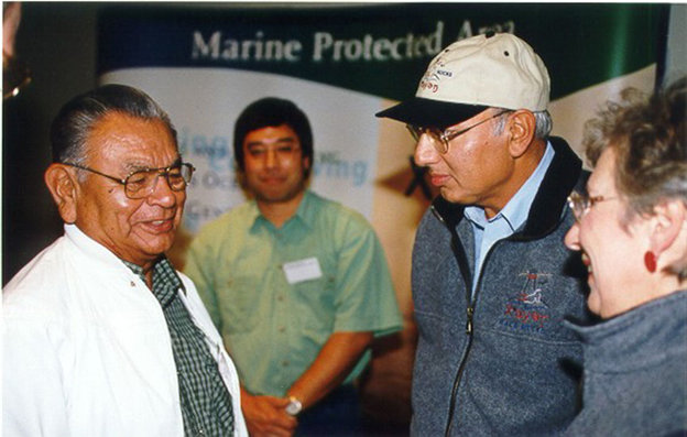
Tom Sampson on the left conversing with Federal Fisheries Minister, Herb Dahliwal and Provincial Environment Minister Joan Sawiki at Lester Pearson College on the occasion of the formal announcement of the creation of the Race Rocks MPA .
First Nations conservation expert Tom Sampson believes that “Our concept of harvesting of the land and ocean are based on the 13 moons of the year—the absolute time clock of nature, ” he explains. “We managed our resources by understanding this clock, which meant there was a right time for everything, and a time we weren’t allowed to harvest.” Tom has organized sessions on the 13-moon concept as part of his work on the Race Rocks marine protected area, where he has worked to improve cross-cultural understanding and appreciation for the traditional knowledge his people bring to the table. “It’s important that people understand that when we talk about the land we’re talking about a relationship that goes back thousands of years,” he says. “We know this land better than anybody else.”
Furthermore, Tom believes that listening is the key to understanding the environment. He remembers his great grandmother telling him to go down to the beach and listen to the ocean, because “if you don’t listen to it and hear the stories, you won’t learn”. Listening to each other is just as important to Tom, and he believes this skill is not being taught to most young people today.
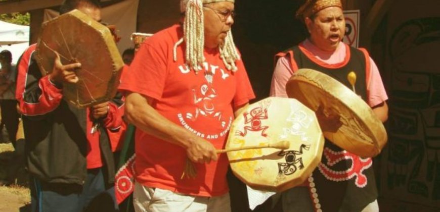
Among many of the skills that are coming back are those of carving, masks, nahnum, potlatch, powwow, storytelling, and totem poles.
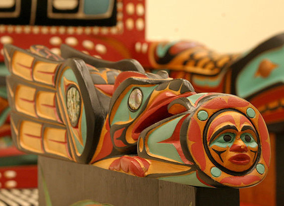
First Nations artists keep old traditions alive and create new ones with brilliant totem poles and carved objects. “For so long we’ve been afraid to do something new because it was not traditional,” Davidson said. “Experimentation is important. If it works, it becomes part of the culture. If it doesn’t, it falls by the wayside.” Robert Davidson, a member of the Haida tribe, who is among a group of contemporary artists infusing fresh life into the rich history of First Nations art.
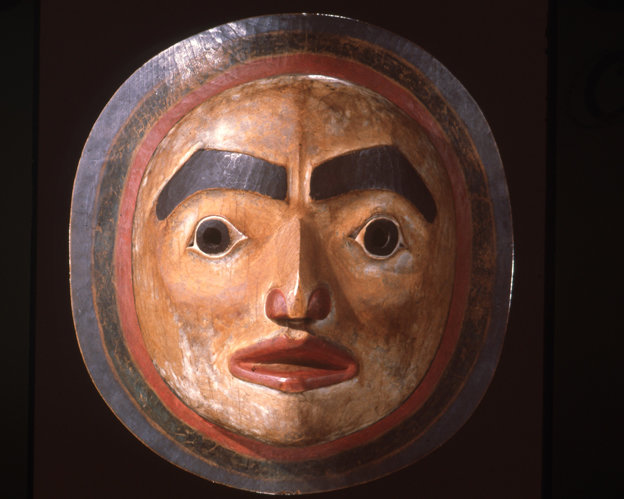
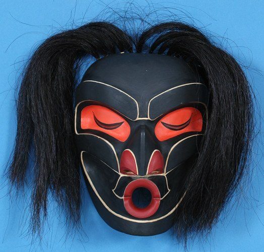
The masks of the Indigenous peoples of the Pacific Northwest Coast are powerful objects that assist us in defining our place in the cosmos. In a world of endless change and complexity, masks offer a continuum for Native people to acknowledge our connection to the universe. Like totem poles, Indigenous masks depict different symbols used in the stories of a tribe. The masks carved for a tribe are used for ceremonial purposes. The most common symbols on masks and totems are the Thunderbird, killer whale, frog, salmon, beaver, bear, wolf, raven, sun and moon.
-Chief Robert Joseph (Down from the Shimmering Sky, 1998)
The ceremonial masks of the Northwest Coast display animals, humans, forces of nature and supernatural beings and play an integral role in Coastal First Nations culture. These objects recount a time when magic ancestors changed themselves from supernatural beings to human forms at specific locations along coastal waterways and rivers. It is these locations that designate the territorial boundaries and homeland of over one hundred independent village groups. Images of these ancestors are displayed on storage chests, utensils, totem poles and monumental carvings, dance blankets, and ceremonial regalia, but recreating this magical past is most dramatically done through the use of masks in elaborately staged theatrical events. The purpose of these performances, is of course to impress, but more importantly, it is to validate the ancient and honorable history of the mask owner's family.
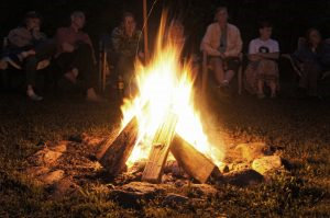
For centuries, people have gathered around Sacred Fires to pray into burning tobacco, one of the four sacred Medicines of First Nations Peoples. The smoke carries their prayers to the Creator. All are welcome to visit. Absolutely no alcohol or drugs are allowed since this is sacred space. The Sacred Fire has become a source and symbol of strength and divine connection to the Creator. The sacred fires that help us govern our community gatherings, ceremonies and prayerful expressions as Indigenous Peoples, continues to be a way for our struggles to be refocused into clear understanding and clear direction about where we take challenges and painful issues facing our community.
First, a decision has to be made as to where the fire is to be lit. The grounds are then blessed with Sacred Herbs and Special Prayers. Large stones must be collected and placed around the spot where the fire will be. Firewood must also be collected, making sure there is enough to last throughout four days of burning, which is the normal time frame for a Sacred Fire. Sometimes small stakes with ribbons are placed at four openings to the fire. This represents the four directions. A special lighting ceremony takes place and then people may begin to do their offerings and there is always a Fire Keeper available to help guide you. At the end of four days, there is a ceremony for letting the fire burn out.
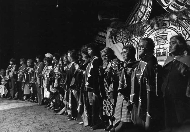
The word "potlatch" means "to give" and comes from a trade jargon, Chinook, formerly used along the Pacific coast of Canada. Guests witnessing the event are given gifts. The more gifts given, the higher the status achieved by the potlatch host. The potlatch ceremony marks important occasions in the lives of the Kwakwaka'wakw: the naming of children, marriage, transferring rights and privileges and mourning the dead.
The purpose of the potlatch was to:
- To publicly recognize class structure and status
- To pass on a family’s rights and privileges or inheritance. Such rights include:
- Rights to land, property, fishing holes, berry patches, hunting grounds, and beach fronts.
- The right to specific dances, songs, stories, and the right to display animal crest designs of a family’s clan.
- The right to wear, use, and display certain regalia and objects that indicate leadership: hats, blankets, dance aprons, carved benches, shield-shaped copper plaques, masks, painted housefronts, and carved posts.
- To celebrate marriages, the naming of babies, and the passing on of chief titles, names held within a family, and names that indicate leadership
- To honor important people who have passed on
- To comfort those who have lost a loved one
- To celebrate the opening of ceremonial bighouses and raising of carved poles
- To recognize the lineage of a family and renew the community’s ties to the ancestors
- To celebrate the people’s relationship to the animal spirits and to give thanks
- To restore one’s reputation in the community after a humiliation
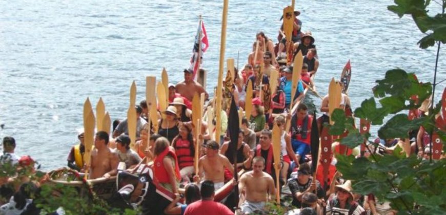
Long ago potlatches stretched out over the winter months, lasting for weeks. They were held in a ceremonial Bighouse, the size of which indicated the hosts’ status in the village. Chiefs with the largest bighouses would invite hundreds of guests from many First Nations. Guests would travel to a potlatch by canoe and upon arrival announce themselves and their village by shouting to the host onshore. Giant welcome figures, carved out of cedar, often stood at the water’s edge as hosts sang welcome songs. Sometimes there were so many guests that no room was left on the beach for all the canoes.
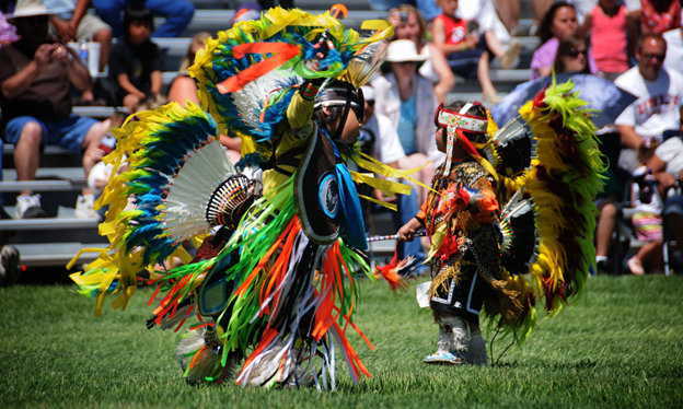
What is a pow wow? A pow wow is a celebration of dance, drums and songs - they are a tradition, a festival, a competition, a reunion, an arts and crafts venue, a food fair - one word cannot encompass the many facets of a pow wow; they are a feast for all five senses.
There are a few thoughts on the origin of the word pow wow. Some hold that it is an adaptation from “pau wau”, an Algonquin word for "medicine man" or "he who dreams”. Others sources say its origin lies in the Pawnee word pa-wa, meaning “to eat”. According to Merriam-Webster, the word is either Narragansett "powwaw" or Massachusett "pauwau".
Generally speaking, pow wows originally were gatherings to celebrate a successful hunt or victorious war party and the dances seen at today’s pow wows have their roots in those events. Under the Indian Act, pow wows were forbidden unless sanctioned by the government for parades and celebrations.
There is a spiritual component to powwows and many traditions are inherent in the dances. Elders teach the dancers the spiritual knowledge they need to be good people and effective leaders. To be a true powwow dancer involves more than just the movements in the dance; it’s a way of life.
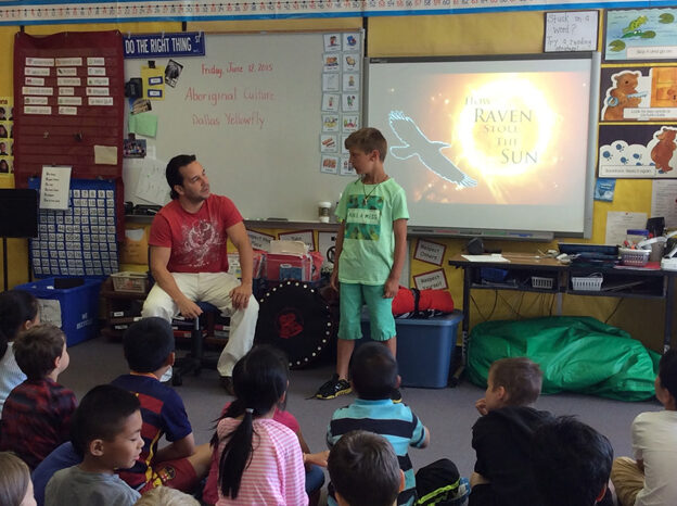
First Nations, Inuit, and Metis cultures have long passed on knowledge from generation to generation through oral traditions, including storytelling. Storytelling is a traditional method used to teach about cultural beliefs, values, customs, rituals, history, practices, relationships, and ways of life.
First Nations storytelling involves expert use of the voice, vocal and body expression, intonation, the use of verbal imagery, facial animation, context, plot and character development, natural pacing of the telling, and careful authentic recall of the story.
☉ Stories can vary from the sacred to the historical.
☉ Some focus on social, political, and cultural ways.
☉ Some are entertaining, even humorous.
☉ Some tell of personal, family, community or an entire nation’s experiences.
☉ Some are “owned” by certain clans or families and can only be told by a member of that group.
☉ Others can be told by anyone who knows them and cares for them.
☉ Stories reflect the perceptions, relationships, beliefs and attitudes of a particular people.
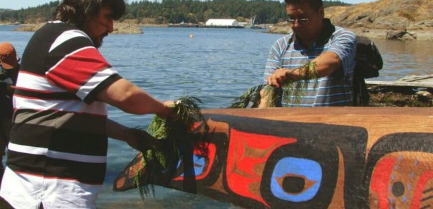
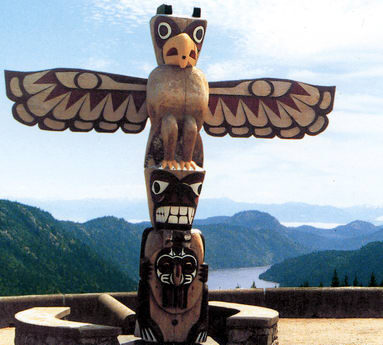
Totem poles are monuments created by First Nations of the Pacific Northwest to represent and commemorate ancestry, histories, people, or events. Totem poles are typically created out of red cedar, a malleable wood relatively abundant in the Pacific Northwest, and would be erected to be visible within a community.
Most totem poles display beings, or crest animals, marking a family’s lineage and validating the powerful rights and privileges that the family held. Totem poles would not necessarily tell a story so much as it would serve to document stories and histories familiar to community members or particular family or clan members.
When a totem is complete, the raising of the pole is cause for celebration that includes a potlatch. Attendees from near and far converge followed by several days of festivities. Totem poles are not simply unique works of art, they are stories. Stories that link First Nations with their past and represent their future. A true testament to the resilience of the First Nations in British Columbia to keep their culture and traditions alive.
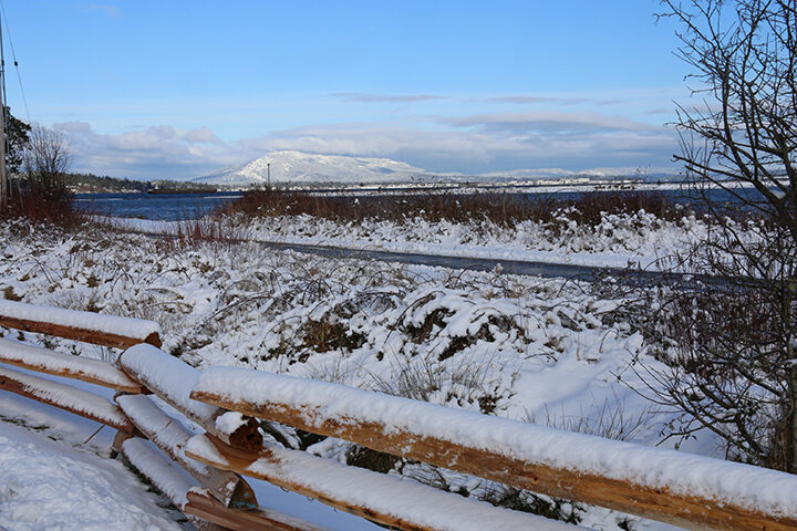
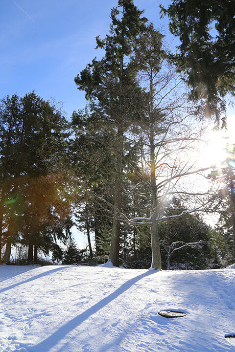
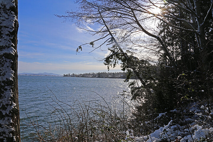
Saanichton Bay Park
Photos and article by Chuck Groot
Saanichton Bay Park is found at the end of Ferguson Road in Saanichton.
It was originally one of the Tsawout main winter village sites. It provided food, shelter from the winter storms, and held significant spiritual significance. It is because of this that we have the Tsawout living nearby today. They have a rich cultural and spiritual connection extending back thousands of years. It is part of the fabric of their being; the four winds, the trees, the birds, the animals, and the fish were all people, long ago. Nature, animals, fish, fire and water are imbued with spiritual values that are honoured for their power to heal, give life, provide bounty, and provide guidance through life.
In 1887, it was the site of an important court battle between Louis Claxton on behalf of the Tsawout Nation and Saanichton Bay Marina group. The group wanted to build a marina there but Justice Meredith ruled that James Douglas “implemented a policy to protect the First Nations in their right to pursue their traditional economy of hunting and fishing” and so concluded “that they had the right to resist… the proposed marina at Saanichton Bay as it would diminish in the extent the fishery contractually reserved to predecessor” of the original signatories to the Douglas Treaty.

The Honourable Sir James Douglas
This landmark decision played an integral part to keeping the Tsawout economic, societal, and spiritual life intact in the area. It is important to note that although the Tsawout were not stationary year-round, this area was the epicenter of their life.
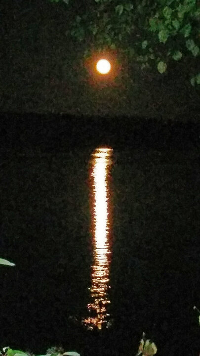
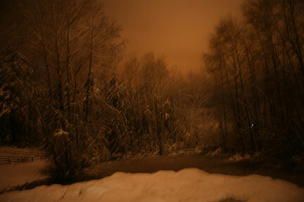
And what a beautiful area it is, especially with a rare snowfall, as seen by the photographs seen below.
Tsawout First Nation
"According to the legends from our forefathers ... People dropped down from heaven ... and each one of these people had a specific trade, like a carver, a hunter, a fisherman ... and each one benefited one another to sustain themselves. They traded amongst each other with their abilities."
(Gilbert Joe, Shishalh, 1992)
First Nations of the South Coast of British Columbia
"We have lived here since time immemorial, thousands of years." (Bob Joe, Chilliwack, 1962)
"We know the Creator put us here. We know our Creator gave us laws that: govern all our relationships to live in harmony with nature and mankind; define our rights and responsibilities.
We have the right to govern ourselves and the right to self-determination. Our rights and responsibilities cannot be altered or taken away by any other nation.
We have our spiritual beliefs, our languages, our culture, and a place on Mother Earth which provides us with all our needs.
We have maintained our freedom, our language and our traditions from time immemorial."
(From the XWE NAL MEWX [Coast Salish] Declaration, 1988)
The Northwest coast of what is now called North America has been home to Aboriginal nations for many thousands of years before any European individual has erroneously been able to do the same. White people only began to arrive to the coast of British Columbia in any significant numbers in the 1850s. Many First Nation elders can testify to a time when our Nations were free from any white influence. During the early contact period, the fur trade between aboriginal peoples and Europeans developed without much colonial control. Trading companies established fortified trading posts, but Europeans at this time remained vastly outnumbered. Robin Fisher (1997) in Contact and Conflict contests that during this time control over Indian lands and societies remained in Indian hands. It was not long before the British Crown endeavored to exercise its sovereignty over indigenous peoples and their lands, which was to become the driving force behind the Douglas Treaties.
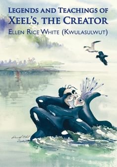
Xeel's
In the shwi'em' (time of the ancient stories) when the world was made "there was nothing on it - just ground and water. "Then, as the Elders tell us, Xeel's, the Changer, "came down to the world to finish things ... he went about fixing things, making lakes and rivers, and all things that grow, and then he made animals and all things like that." Xeel's dropped the first people from the sky to populate the land. A man named Syalutsa' landed on a grassy field called Tsuqwulu on the southwest side of the mountain Swuqus overlooking the Cowichan Valley. A little further north Stutsun fell from the sky and landed on the mountain Skwaakwnus above the Chemainus River. Other people emerged out of the land itself. At Penelakut on Kuper Island two great cedar logs lay by the shore. Warmed by the rays of the sun, the bark on one of the logs cracked and out came the first man on the island. Within a short time he was joined by the first woman, who emerged from the sand between the two logs. Syalutsa', Stutsun, and the others who landed atop the mountains and hills of Vancouver Island or emerged from the driftwood and sands of Kuper Island are the ancestors of the Hul'qumi'num First Nations. They are mustimuhw (human beings) also called hwulmuhw (people gathered in one place).
The Beliefs of the WSANEC Peoples
It is the belief of the Saanich people that XALS put us here on this world and gave us a language of our own called SENCOTEN.
That the Lands around us came from XALS and the islands, points land and huge boulders were once people and are still referred to in their old names.
That the four winds, the trees, the birds, the animals, and the fishes too were people at one time long ago.
That the living things can understand us if we speak to them using special words.
That among us are special people who have special rights in regard to spiritual communication.
That the islands, the salmon and the living things can be called upon for help to survive in this life.
That the fire and the water have a life and spirit too, and that they can assist in the communication beyond this life.
That beyond this life, life continues and that, at times, communication can take place with relatives who have left this world.
That the origin of the living things of this world are our ancient relatives, and that they must be treated with respect.
That there must be honour given to life around us, that ceremonies and rituals taught to the young will perpetuate these as time passes from one generation to the next.
That when our relatives leave this world they enter the sky world. The stars represent the twinkling of their eyes as they look down upon us a night.
That the Thunder Being lives in a cave in LAUWELNEW, our Sacred mountain and that he is the communicator between this world and the sky world.
That the KEXMIN, Indian consumption plant, is a good medicine used to clean and open the way for the pure spirits to come near.
That is Saanich there is EN SKAU, a destiny based on what a person does. If one does good or one does something not good to one another or to the living things around us, it will return to that person in this life.
It is the belief of the Saanich people that the SXOLE (reef net) is a gift of the salmon spirit who came to our land and took a beautiful lady from Saanich for his wife.
The Saanich have lived to these and many other beliefs for thousands of years.
When the Saanich people lived on this land ALENENEC, our homeland according to the teachings and beliefs given to us by XALS, Our Creator, life was good and plentiful. When the Saanich people forgot the teachings and did not honour life, XALS, Our Creator, punished the Saanich people with a flood. Only the ones who lived by his beliefs and teachings survived the great flood.
These are our beliefs.
This is our History
This is our Culture
The Changer, Xeel's, created biodiversity - the resources used by the first people and the snuw'uy'ul (the cultural teachings), which governed all manner of conduct and interaction with the physical and spiritual realm.
Saanich Mythological Figures

Xe'las (also spelled Xelas, Haylas, Hals, and other ways): A Transformer figure, often known as the Changer in English, common to the mythology of many Northwest Coast tribes. The Changer brought balance to the world by using his powers to change people, animals, and the landscape into the forms they have today.
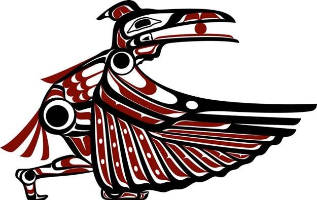
Raven: Raven is a culture hero of Saanich, Samish, and Lummi mythology. He is a benevolent figure who helps the people, but at the same time, he is also a trickster spirit, and many Saanich stories about Raven have to do with his frivolous or poorly thought out behavior getting him into trouble.
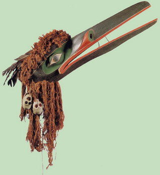
Reven Mask collected at Xwamdasber 1881
Mink: Mink is another Straits Salish trickster character. Indeed, some of Raven's more light-hearted adventures are sometimes told with Mink as the protagonist instead. However, compared with Raven, Mink is a more negative character who primarily embodies traits that are looked down upon by the Salish people (greed, recklessness, arrogance, inappropriate sexual behavior, poor hygiene, etc.) Saanich and Lummi stories about Mink are often humorous, but also are cautionary tales about how not to behave.

Basket Ogress (Ch'eni): A giant cannibal monster who catches human children and carries them off in her enormous pack basket.
Community Information
The Tsawout First Nation is one of five bands that constitute the Saanich Nation. The other bands of the Saanich Nation are Tsartlip, Tseycum, Malahat and Pauquachin.
The Tsawout First Nation is a First Nations government located on Vancouver Island, British Columbia, Canada. They are a member of the Sencot'en Alliance.[1] In the 1850s they were signatories to the Douglas Treaties.[2]
The Band's offices are located in Saanichton.
East Saanich IR No. 2, the Tsawout First Nation main village, is about 15 minutes north of the City of Victoria and lies on the east side of the Saanich Peninsula. The village (“reserve”) can be accessed via Highway 17 - Pat Bay Highway. We have a population of 1600 people living in Tsawout (year 2006 est.) with approximately 1/3 of the population being registered band members, and others being residents who are leasing lands from landowners.
East Saanich IR No. 2 is approximately 241hectares in size (595 acres) total area. There are single family residential, and leased modular homes, band administration and commercial developments. The commercial developments include motels, restaurants, offices and gas stations. We have a community water and sewer system in place. Our water system is supplied by the Peninsula Water Commision, and Tsawout has its own sewage treatment facility.
Saanichton Bay has historically been, and continues to be significant to the Saanich peoples of Tsawout. The bay provided shelter from the prevailing southeast gales of winter, a year-round source of food, as well as playing an integral role in the Tsawout economic, societal, social, and spiritual life. Because of these reasons Saanichton Bay was one of the main winter village sites of the Saanich peoples, and that is why Tsawout “Indian Reserve” is located there today
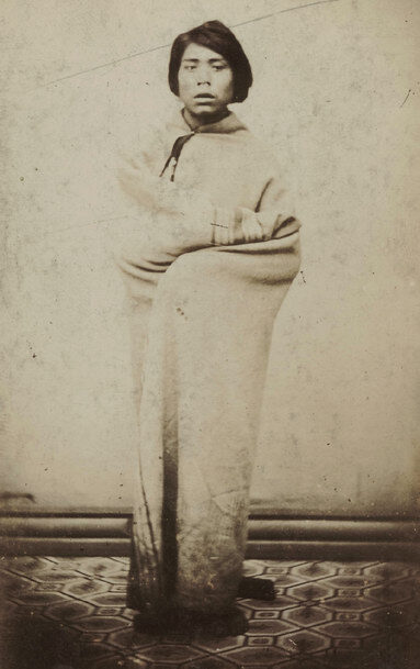
Young Saanich woman c. 1868
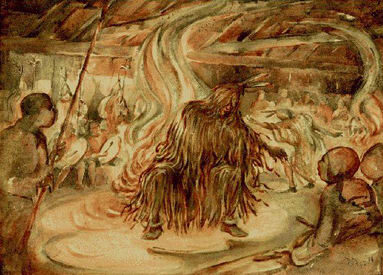
Tsawout Longhouse Dance c. 1932
Painting by Arthur Pitts
It is important to mention that the people of Tsawout were not stationary at Saanichton Bay year-round, though this was our "headquarters". The Saanich peoples territory includes the Saanich Peninsula, south to Mount Douglas, across to Mount Finlayson and Goldstream. In addition, the Southern Gulf Islands, reaching to Point Roberts, and San Juan Islands constituted what is the Saanich Peoples traditional territory. The Tsawout and Saanich people’s traditional territory is the lands and seas that we traditionally used throughout every season. Names were given to all places we knew, every bay, every stream, every village, every mountain, every lake, every inlet, and island has a name in our language, the SENCOTEN language. Our Language, place names, stories, history is what defines our territory and speaks to our long standing relationship to the land and waters.
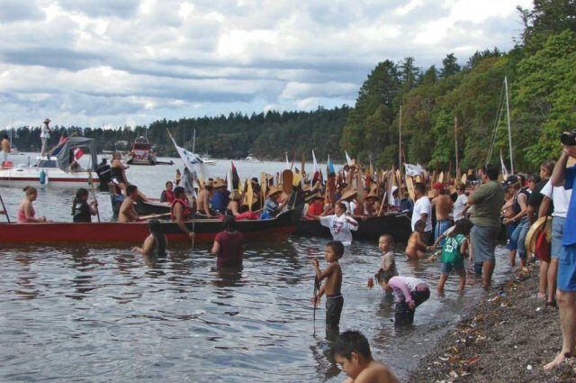
The Saanich people are renowned for their canoeing skills. Watched by some 12,000 spectators, "West Saanich No. 5" won the International Indian War Canoe Race at Coupeville in Washington on 10 August 1936. The famous Saanich - Tsartlip canoe, carved from a single massive red cedar tree, was photographed as it reached the half mile point.
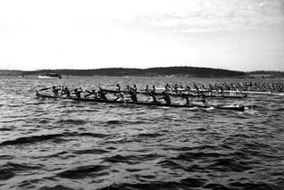
Winning war Canoe c.1936
The prize winning war canoe "West Saanich No. 5" is seen in a c. 1929 photo (left). The twelve canoe pullers pose with two of their trophy cups. From right to left: 1) Marshall Henry (the canoe carver and owner), West Saanich and Malahat; 2) Baptiste Paul (the famous wrestler), West Saanich; 3) Joe Seymour, Chemainus Bay; 4) Chris Tom, Cole Bay; 5) Peter Henry, West Saanich; 6) Fred Huston, North Vancouver; 7) Howard Olsen, West Saanich; 8) Fred La Tasse, West Saanich; 9) Jasper Charlie, Beecher Bay; 10) Joe Bartleman, West Saanich; 11) Isaac Bartleman, West Saanich; 12) Johnny Sam, West Saanich.
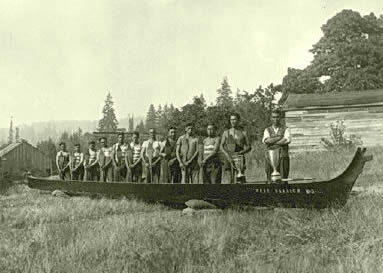
Winning Saanich War Canoe c. 1929
The Tsawout people continue to play a prominent role in nurturing and protecting the land today. They are a vibrant and important part of the landscape and community. Thank you for all you do.
The Saanich Fall Fair

No one is exactly sure where the first fair was held but today there are more than 3,200 fairs held in North America each year. There is a record in the Bible, in the book of Ezekiel talking about a fair 500 years before the birth of Christ. In North America we have the first recorded fair held in Windsor, Nova Scotia in 1765.
Basically a fair is a gathering of people for entertainment and commercial activities. Many were held to sell produce, livestock and other trade goods. It was also a way to view new equipment, techniques, and animal husbandry. Trade Shows and Festivals were the first two types of ancient fairs. The Brits were the first known to have crossed the two and came up with the Agricultural Fair.
Saanichton Fair (courtesy B.C. Archives)
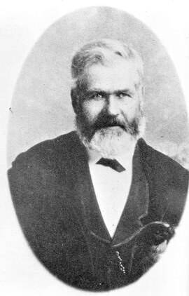
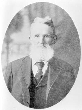
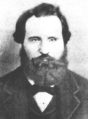
The first European settlers arrived at the Saanich Peninsula in 1852. The Saanichton Fair comes from a long and storied history Ten farmers soon met and formed an Agricultural Society in 1867 to promote what it was like farming. It was originally started by Robert Brown, Captain George Steven Butler, George Thomas, William Turgoose, J.T. McIlmoyle, Thomas Michell, Peter Emrie, Duncan Lidgate, Henry Simpson, and William Thomson. All names that are rich in the history of the Peninsula.
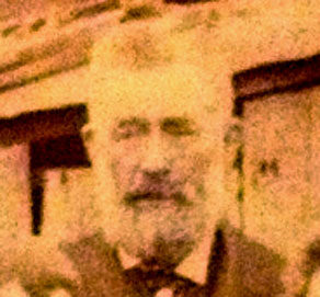
Captain George Steven Butler a legend in Saanichton, bought 120 acres of land in 1868 and passed away in 1885.
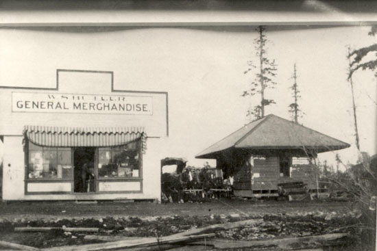
Butler’s store and Victoria and Sidney railroad station at Keating. Saanich archives.
George Thomas
William Thompson
William Turgoose
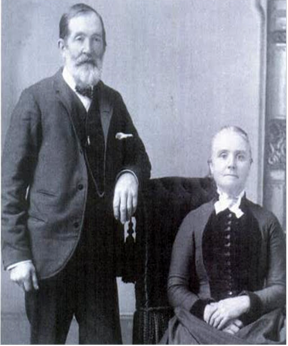
Thomas and Margaret Michell
Duncan Lidgate
Henry Simpson
For the first four years the fair was held in different locations. From there the committee purchased land in 1873, from Henry Simpson, who in fact gave them an excellent deal. The Saanich fair moved in 1993 to its current site on Stelly’s Cross Road. Polo grounds now reside where the original fair stood.
Our fair promotes itself as the oldest continuous fair in Western Canada, no small feat. This year it will mark its 150th birthday – congratulations!
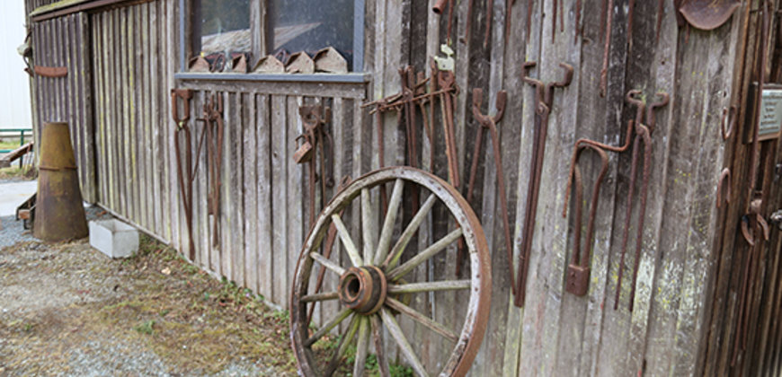
Heritage Acres
– Where Families Come Together To Have Fun
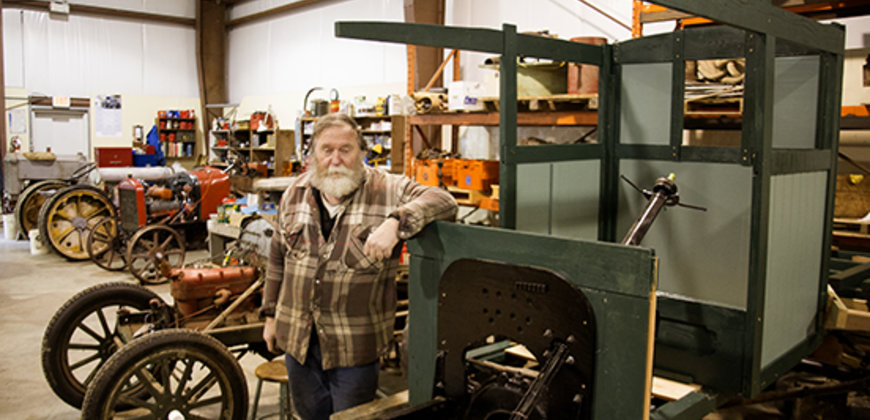
Truly passionate individuals who keenly desire to preserve our unique and special past, is how I would describe the fabulous people I met at the Saanich Historical Artifacts Society, also known as the Saanich Historical Society, or “Heritage Acres”.
We are very fortunate that it was founded in 1968 by Willard Michell and a group of enthusiastic supporters. In fact, it was really started much earlier than that, probably during the late 1920’s. This is when Willard, a member of a long-standing farm family of the region, started collecting odds and sods. Back then, you never threw anything out, after all, you never know when you might need something.
The first workshop was on Willard’s farm. Meeting were help in members’ homes and the first building was temporarily set up on the Saanichton Fair Grounds. With the help of B.C. Land Commission and Central Saanich Municipal Council they received grants and the permanent location they now enjoy.
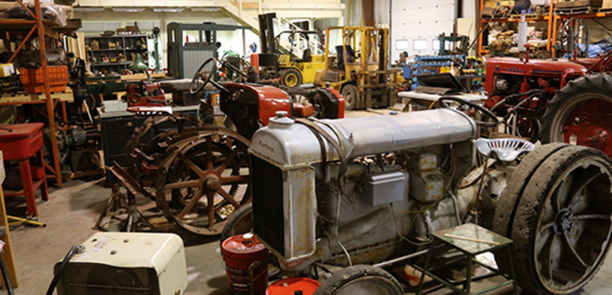
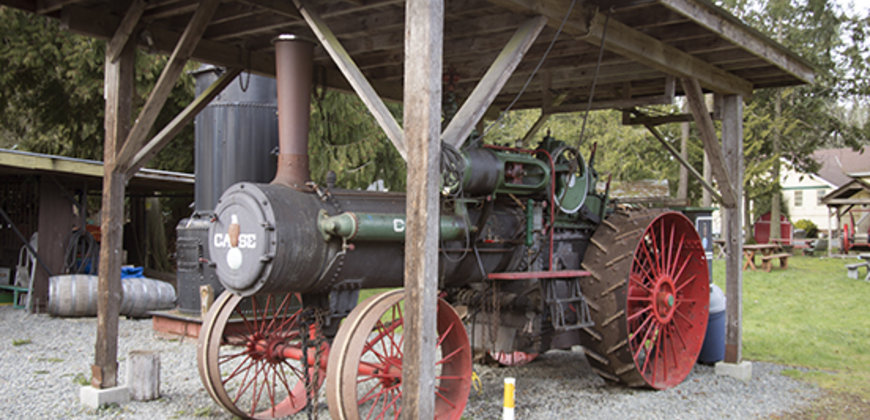
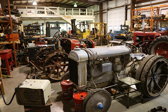
Today the dedicated members of the society are sharing the wealth of their knowledge in the areas of mechanics, construction, welding, hydraulics, and blacksmithing to name a few. They welcome anyone who would like to join them as learners, teachers, or enthusiasts. They also would be happy to accept any donations of old tools, farm and household equipment.
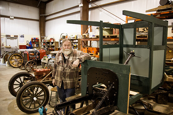
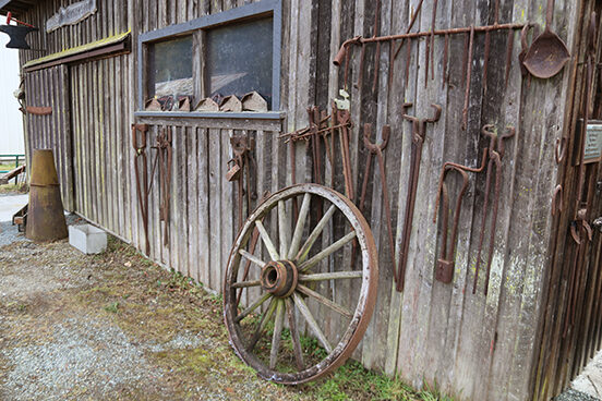
They have many wonderful things to see and do. The Society is dedicated to collecting, restoring, and demonstrating artifacts from Saanich's rural past
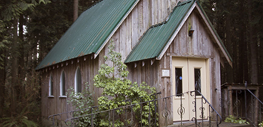
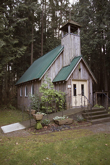
There is a Log Cabin;
Chapel;
The Moody Gosset Building (the oldest metal building in Canada);
The Newman Building (a fabulous collection of marine artifacts, cameras, and photographs;
The Tillicum Building (home of a fantastic carriage collection);
Home of the Famous Vancouver Island Model Engineers (a separate group who run several different scale model trains around);
The Hatch Car Shed (an incredible collection of scale tram models crafted by Gordon W. Hatch, after the original that operated in Victoria and the Peninsula);
General Store;
Gardner’s Garage;
Carpenter Shop;
Saw Mill;
Planer Shed;
Blacksmith Shop;
And the Picnic Grounds.
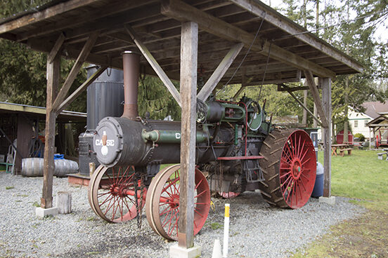
Every year they have wonderful events for all the family to enjoy; Car Shows, Farming demonstrations, Seminars, Picnics, Fall and Winter Displays, and a whole lot more. Their facilities are a great place to hold your next meeting, seminar, or wedding. They have one of Western Canada’s largest collections of working steam engines, tractors, agricultural machinery, and household and industrial artifacts. As a matter fact, kids (and parents) can climb all over the farming equipment, see the mini railroad, a sawmill, planer mill and other artifacts at this 12-hectare site with a small lake, forest trails and pond.
The Saanich Historical Artifacts Society meets on the last Saturday of each month in the School House at 12 noon. Everyone is welcome. Individual memberships are $20.00 per year and Family memberships are $30.00 per year, payable in January.
Summer Hours: June 19 – Sept 17 9:30 am – 4 pm, daily
Winter Hours: October – May 9:30 – noon, daily
Trains run on various days from 12 – 3:30
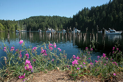
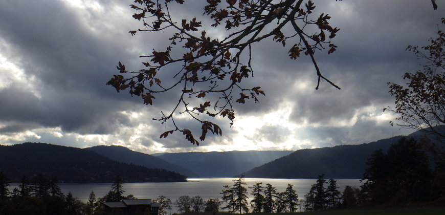
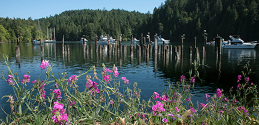
Tod Inlet
A spectacular scenic little jewel off Brentwood Bay; Tod Inlet is found in Gowland Tod Provincial Park. You meander down a gentle gradual downhill grade, through lush forests with the melodious sounds of Tod Creek in the background. On the way, there a many beautiful flowers, plants, and bushes. You might even get to spy the many little inhabitants and wildlife that call this their home. In fact, there are over 150 different types of animals and plants to be found here.
We thank our First Nations brothers and sisters for the use of SNID₵EL (pronounced sngeet-kwith), meaning “place of the Blue Grouse”. Many riches of the area are still used by the WSÁNEĆ (Saanich) First Nation for medicinal, ceremonial, and spiritual values.
You can enjoy over 25 kilometres of trails, ranging from easy to medium in difficulty. Not to mention you will enjoy the measured change from a rare, dry coastal Douglas fir habitat to a protected wetlands and riparian areas. Todd Inlet was originally established on July 22, 1995 as a Provincial Park under the Commonwealth Heritage Legacy Program to commemorate the XV Commonwealth Games held in Victoria in 1994.
It was named after Jon Tod who was a chief trader for the Hudson Bay Company. Tod was known as a “diamond in the rough”, a man of excellent principle, but vulgar manners, well read, musically gifted on the flute and fiddle, and loved nature. He came to Victoria in 1850 and retired to Tod House in Oak Bay in 1852.
Back in the day, Tod Inlet was used by the Portland Cement Company to ship its cement from Victoria to San Francisco. For over nine years, from 1904 to 1913, Robert Pim Butchart mined the limestone deposits and when the limestone ran out his intrepid wife Jennie had a vision to turn the abandoned quarry into a garden of Eden. There was also an early copper mine in the area.
Scattered about you will find a few of the last vestiges of the operation; old buildings, train tracks, pillars and other detritus. A quiet testimony to its industrial past, but vastly overshadowing this is the rustic beauty of the park and the incredible exquisiteness of gardens found next door thanks to Jennie Butchart’s vision of the now world famous Butchart Gardens.
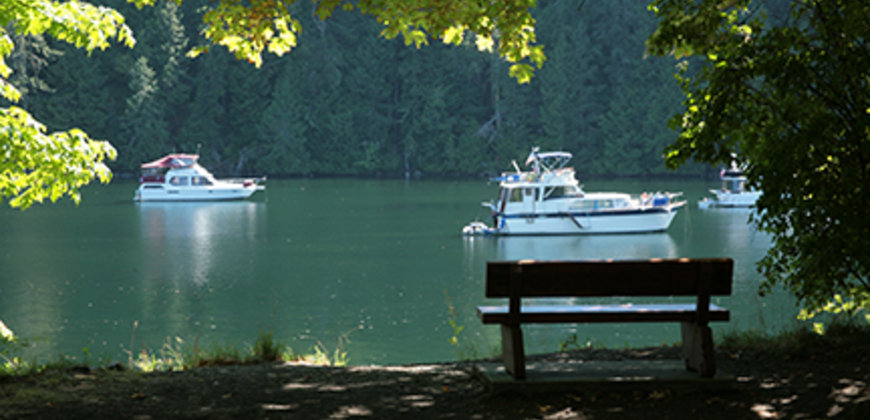
Once you arrive in the inlet you enjoy the tranquil scene of a quiet little inlet surrounded by towering Gowland Range (430 meters over Finlayson Arm) and majestic Douglas Fir and other assorted trees. In the water, you will see pleasure craft of all types and sizes, gently bobbing, relaxing, soaking in the zen vibes of the oasis.
There are many groups, chief among them is Seachange Marine Conservation Society and the Friends of Tod Creek, who are working diligently to restore, preserve, and maintain the richness and beauty of Tod Inlet.
For information on how you can help, visit the SeaChange Marine Conservation Society website and the Friends of Tod Creek Watershed website
50 Years of VRCM
By Bob Stovel
Here is how it all started fifty years ago…..
In the summer of 1966 a small group of local flyers were using the soccer pitch at the University of Victoria on a semi-regular basis. Roy Foot, one of these guys, had the idea to start a formal club. There followed a meeting at Walt Morgan’s house on Bay Street. About ten flyers showed up and Roy chaired the first meeting. “Who would like to be President?” Roy asked. “Why don’t you do it” we said…..it was your idea!! OK…..I’ll do it he said, but we need a name. Roy liked the magazine RC MODELER so suggested that we call the club VICTORIA RC MODELERS. The name would cover more activities than just flying. All agreed and the name has stuck (with the addition of “Society” which came later).
We successfully flew at UVIC for a short time but there were too many “I haven’t got its” and we were asked to leave. We flew at a number of places for a couple of years (school yards, Gordon Head, Lansdowne, Stelly’s field etc.). Also a field on Lochside a few hundred yards off Martindale. We welcomed an opportunity to use the polo field on Puckle Road….off Island View Road, about a kilometer north of our present field. We gladly paid a rental fee to the Polo Club and enjoyed that site for a couple of years. The Polo Club said that they had found another field that would be suitable…..it was a field on East Saanich Road owned by a Michell (Verne Michell’s cousin). This was another great field for a couple of years until the neighbors again complained about the noise to the Central Saanich Council and who promptly forced us out.
Randy Ben, a lifetime Central Saanich resident and a good friend of Vern Michell started discussions with Vern to use part of his field. Vern subsequently gave us the use of a small part of his land which was not suitable for crops and a reasonable rental rate was agreed upon. This is the property that we now enjoy. Weeks were spent preparing the field for a runway. John Van Haaf built a metal gate and we installed a metal culvert in the ditch at the entrance. The club flourished
We then had to deal with the Central Saanich Council, the CRD, our neighbors and our landowner. We had to show that we were in control of the sound being generated at the field and we had to show that we were a viable member of the community.…..to do this we hired BKL Consultants, a professional sound engineer from the mainland to take sound readings under many different conditions. We obtained and studied a copy of a professional sound report done for the Cowichan Regional District by Wakefield Acoustics. This report related to the proposed “Noise Park” north of Duncan…..a very similar noise problem. From these reports we developed a workable sound testing criteria. We hired a BC Land Surveyor to legally identify the land that we were using. We petitioned three thousand signatures from the day to day users of the Lochside trail. We relocated the runway to avoid overflying neighbor’s property. We set up a testing system to assess the skill level of our members. We established an airplane testing system to control the quality of model construction. We established “no-fly zones” to control the overflying of private properties. We established new daylight flying hours. We encouraged the use of our field facilities by the public. Armed with this data we met in mass at a public Council meeting to state our case. The result was in our favor and we now have a written permit identifying our field as being officially zoned for model airplane flying……not many of these in Canada!!
In 2001 Mike Scholefield along with help from Jack Price started our annual “Victoria’s Largest Little Air Show”…..Probably the best thing we ever did as a club. The Air Show has generated over $265,000.00. For two very special charities for 14 years 100% of the proceeds raised at the show were donated to C-FAX Santa’s Anonymous and the Saanich Peninsula Hospital Foundation. From 2016 it became a Santa's Anonymous event. Not only that but this annual event has brought the members together to work as a club. It has given us a special purpose that did not exist before and we are respected for it by our neighbors.
Ethereal Glow
Scene from behind the Butler Brothers pit by Keating Cross Rd.
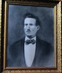
From military man, to gold miner, to farmer; Captain George Butler laid the groundwork for his family and left a legacy for all to appreciate. The Butlers have a long and integral history on Vancouver Island and particularly in the Central Saanich area. Captain Butler originally came to Central Saanich and was farming when he married his wife Fanny in 1868. He died young, at the age of 51 of consumption.
Fanny lived to the grand old age of 79, supporting herself and her family by giving piano lessons. She was also said to having been one of the first school teachers in the area. History has it that Wally and Claude were twins and when born prematurely in Brentwood in 1911, they were initially kept warm through the oven heat of a woodstove, truly a pioneer beginning.
Butler Brothers is a well-known name in the area providing a wide range of building materials to lower Vancouver Island. Logging and gravel were the mainstays of the business in the 1930’s. They made many innovations to equipment and trucks which enhanced the industry in general. Their off-road log hauler Mark V, believed to be the largest logging truck in the world. This was the final version in a series of prototypes, enormous off-highway trucks locally designed and built for the company in the 1970s and 1980s. Built with a double axle, this truck could haul up to 150 tons of logs.
The brothers who incorporated the company in 1954 were Claude, Wally, Tom and Eric. All grandchildren of the Captain. In fact, great-grandson Brian is at the helm today.
The legacy of the Butlers continues to grow. Claude Butler served as president of the Victoria Flying Club several times over the years. He was a successful businessman, inventor, and a man with many visions. His compassion and generosity knew no bounds.
Today, Butler Brothers Supplies Ltd. has three gravel pits in operation - Keating Cross Road, Sooke and Duncan - and sells ready-mix concrete from Keating Cross Road, Bay Street in Victoria and Sooke.
Butler Brothers Supplies Ltd. continues to grow to meet the needs of Island consumers and to carry on the tradition of quality, integrity and service to Vancouver Island communities.
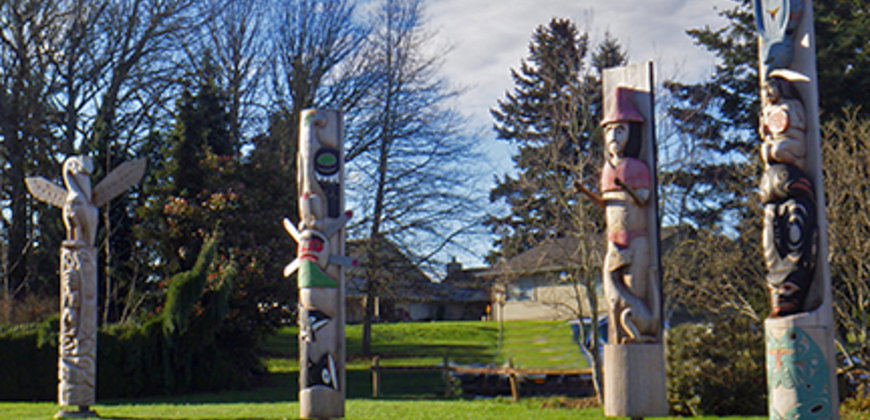
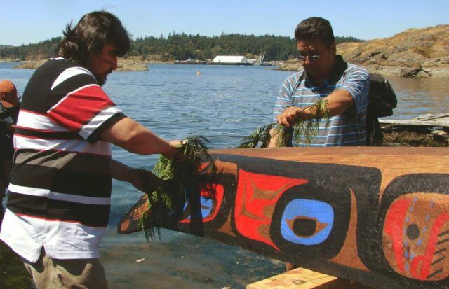
Totems at the Saanich Peninsula Hospital
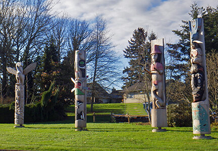
Carvers from Tseycum, Tsartlip, Pauquachin and Tsawout have created welcoming totems at the Saanich Peninsula Hospital.
The lawns of the Saanich Peninsula Hospital have been transformed and are home to four 15-foot, locally carved cedar totem poles. A collaboration driven by first Nations communities on Vancouver Island supported by a number of partnerships on the traditional territory of the WSANEC First Nation communities. “These totem poles honour the ancestors and represent the peoples who have always been in this territory and share a message of how we can work better together as neighbors and partners. They are also a way to honour and the recognize the service providers and caregivers, supporting them to reflect on cultural humility, and how to best offer culturally safe services in a health care setting.” Lydia Hwitsum, board Chair for the First Nations Health Authority.
For the $120,000 project, large cedars were donated by Western Forest Products and carved in several distinctive styles in a few months by Tsartlip carver Charles Elliott, Tseycum carver James Jimmy, Pauquachin carver Mark Henry and Tsawout carver Doug LaFortune, who said his pole was “a log for a long time — it took a long time to come out.” Charles Elliott at the Tsartlip Village [WJOL̵EL̵P] in Brentwood Bay knows good logs from bad, and was delighted to receive a beautiful piece of old growth red cedar, knot free. Good carvers only work on old growth timber.
Charles explained the design of his pole. His pole has a marine theme to celebrate the Salish Sea which connects all living beings in this territory. The frog [WEXES] sitting at the bottom is a guardian creature who announces change and new beginnings. They are at home on land and water and connect the two worlds.
The orca [KELL̵OLEMEC’N is the ruler of the Salish Sea that surrounds the W̱SÁNEĆ Peninsula and is visible from the hospital. In Coast Salish culture, orcas are the most respected creature of the sea, revered for their intelligence and power. They also set a good example for humans, as they protect their young and stay true to their pod. The drummer[WDILEM] and orca sing a traditional welcoming song to all people coming to the hospital. The kingfisher [T̸ETĆELE], diving down from above, demonstrates its prowess as a fisherman and shore keeper in Coast Salish culture. They watch over the shores from the skies, trees and cliffs, and protect other living beings by announcing the arrival of visitors with their call.
Mark Henry is from the Pauquachin First Nation [BOḰEĆEN]. Mark and his brother Herman are two of ten siblings, all of whom are working throughout BC. At forty years old, Mark is the youngest son and, according to Herman, has always worked with his hands. In order to get the inspiration he needed to carve his fifteen foot pole, he spent two days simply walking around the Saanich Peninsula Hospital, listening and observing life at the hospital.
After spending time at the hospital, Mark had the vision needed to create the pole that would represent his people. The pod of orcas [qulΪanumutsun] at the bottom of this totem represents the nurses who work together as a team to skillfully guide, teach and protect their young. The sun [sumshathet] that rises over our land and mountains is for the Elders, because they say they love seeing the sun come up every day. It provides warmth and hope, and enables all living things to grow and thrive. The eagle [Yuḧwelѐ] at the top is there to provide strength and vision to all those who come to the Saanich Peninsula Hospital.
Like Charles, Mark uses a small chainsaw to remove the large pieces of the log, but the real artistry is done by hand. Mark explained that it takes about three months to finish a pole.
Doug Lafortune and his brother Aubrey are carvers who have passed the knowledge and skills to Doug’s son, Bear. All three men are involved in the creation of the Tsawout pole. The story behind Doug’s pole is a welcoming figure [S’WQENÀ L̵EN] with outstretched hands greets all those who come to the hospital. The lively, spirited otters [SKA’EṮ] swim playfully around the welcoming figure. The stately blue heron [SNEK̵E], keeper of the cool, early morning fog, stands for hours on the shoreline, symbolizing patience and perseverance. The SENĆOŦEN word for blue heron means, “loud noise.” Herons and otters are predominant figures in Coast Salish culture and there are many of them in the W̱SÁNEĆ territory.
Finally, James Jimmy of the Tseycum First Nation. James’ carving represents the legend of the Tseycum Messenger[WC̸ESES ET]. In ancient times, a man from Tseycum carried messages between villages. He was always accompanied by a wolf [STK A̸ A̸YE], who was his faithful companion. One day, he needed to swim to Salt Spring Island to deliver a message but the wolf would not leave the shore of Tseycum. When the messenger turned to look back from the water, he saw the wolf on the beach. The Creator had turned the wolf into a rock that remains to this day at Tseycum.
The Blue Heron
Adept in fresh water and salt water alike, the Great Blue Heron is a majestic sight to behold. We often see it standing motionless for long spells at a time but it is definitely not asleep, rather patiently blending in to its environment scanning for its doomed prey. Although its’ slow, deep wing beats look slow and purposeful, it can strike with lightning speed and accuracy.
It is one of the largest of the North American herons. It appears blue-gray from a distance but has many shades and can actually be seen as pure white in Florida. They live in a variety of environments from lakes, rivers, marshes and sloughs to grasslands and agricultural fields. That is why they love Vancouver Island.
They are great fishers and have been known to choke to death on fish that are actually too large for them to swallow. Although fish are their mainstay, they enjoy mice, insects and other small creatures to bring some variety to their diet.
Tall trees are their preferred habitat, but can been found in low shrubs. Although they hunt alone they live in colonies. The female will lay anywhere from 2 – 7 eggs which both parents will protect and incubate.
From our First Nations friends we learn that the Blue Heron brings messages of self-determination and self-reliance. The ability to progress and evolve are two of the gifts they teach. Another wisdom they impart is that you don’t need two massive pillars to anchor you but rather learn to stand on your own. If they had a motto it would be, “Follow your heart, create your own circumstances.” The Blue Heron symbolizes patience, grace, balance, elegance, and determination.
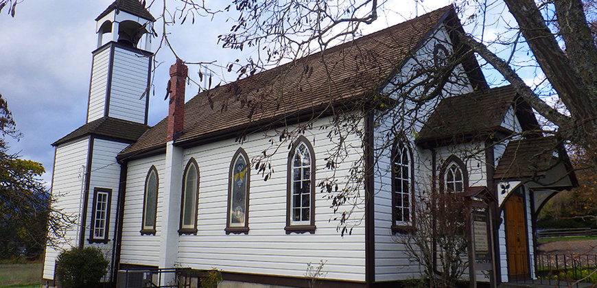
Our Lady of the Assumption
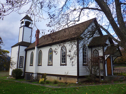
A remarkable history marked the birth of Our Lady of the Assumption. Set in arguably one of the most beautiful locations on Vancouver Island it had the humble beginnings of a mission to serve the First Nations in the area. Although idyllic beyond measure there was a lot of conflict between the First Nations Tribes of Tseigurn, Pauquechin, Tsardip, Salish, Haida, songhees, Snohomish, and Cowicjhan to name a few; who all vied for the rights to the beauty and rich resources. These were later diminished by the Douglas Treaties.
The Oblate priests originally established the mission and did much to serve the First Nations people in the area. Rev. Father Lempfrit was the first to come in 1850; leaving a legacy of baptizing over 250 First Nations in the week he visited. He was followed by Father Chirouse in 1859. It wasn’t till 1860 that Father Jayol, Brother Blonchel and several First Nations People built a log church. It wasn’t until 1865 where Father Mandart came and established a formal mission complete with a proper church.
The tradition of Dutch priests continued with Father Vullinghs who served from 1893-1909. To this day the dutch are involved with Father Rolf Hassenack as Pastor of the church and St. Elizabeth in Sidney.
7742West Saanich Rd
Brentwood Bay, BC Canada
V8L 3S6
Mass is held at 8:30 a.m. every Sunday.
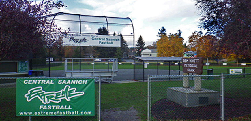
Rom Knott Memorial Park
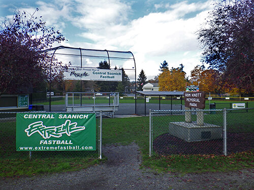
Love and respect make for a lasting legacy. Rom Knott was an enthusiastic sportsman and dedicated coach who coached girls baseball for many years, including winning the 1954 Provincial Championship with his Bantam Girls. Unfortunately he died in a tragic automobile accident in 1964.
His friends and family came together and bought the existing land and developed it as a playing field for baseball and a kids playground. A fitting memorial for a great guy. It was later developed and through the generosity of the Lions Club and the municipality was expanded to include beautiful green-space, a toddler playground, concession and storage building, and of course a fabulous softball diamond. There is also another play area for older children in memory of Stan Bickford.
The park is located on Wallace Drive, right beside the Central Saanich Seniors’ Centre.
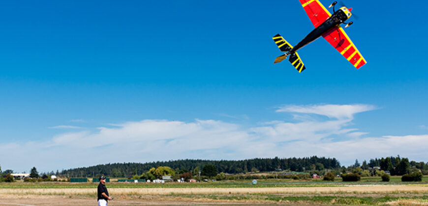
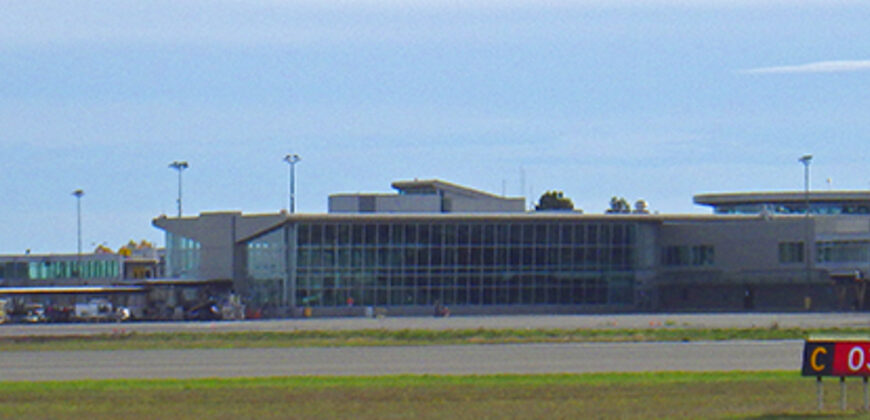
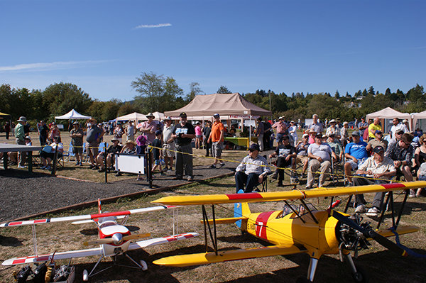
YYJ our Pride and Joy
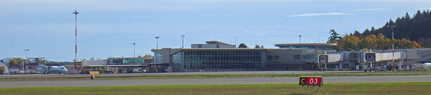
From it’s humble beginnings in 1939 as a grass strip seeing many flying boats, it now boasts a beautiful airport hosting international flights. As a matter of fact, in 2015, there was over 55,300 local and almost 82,000 international flights. And this number looks to be surpassed in 2016.
Although it technically is in North Saanich, we like to feel we share in the heritage as it is only 8.3 km across the field. Alright, it is a little more than a field, in fact it is approximately 1,198 acres is size. One of the key things is that it is near and dear to the heart of the Victoria Airport Authority to be a leader in environmental protection and management; one of our goals as well.
Some of the aspects that are monitored and tested constantly:
- Storm Water Quality
- Potable Water Testing
- Sanitary Source Control
- Habitat and Wildlife Management
- Spill Response
- Glycol Recovery and Monitoring
- Green House Gas
All the while managing the 10th busiest airports in Canada. No wonder people come and watch the flight traffic. Next to a small cemetery, on the south-east side of the airport on Canora Rd., is one spot dreamers love to watch the planes take-off and land. Another great spot is on the other side of airport where there is an open field off Mills and Meadlands Road.
Whether you are coming, going, or just visiting the Pat Bay Airport, or should I say, Victoria International Airport is a great place to dream, look at great art, or just passing the day.
Weather Statistics
| Climate data for Saanichton | |||||||||||||
| Month | Jan | Feb | Mar | Apr | May | Jun | Jul | Aug | Sep | Oct | Nov | Dec | Year |
| Record high °C (°F) | 15.5 | 16.1 | 20.5 | 25.5 | 31.5 | 33.9 | 34.4 | 32.8 | 30.5 | 27 | 17.8 | 15 | 34.4 |
| 59.9 | 61 | 68.9 | 77.9 | 88.7 | 93 | 93.9 | 91 | 86.9 | 81 | 64 | 59 | 93.9 | |
| Average high °C (°F) | 6.7 | 8.1 | 10.2 | 13 | 16.4 | 19 | 21.8 | 21.9 | 19 | 13.8 | 9.2 | 6.8 | 13.8 |
| 44.1 | 46.6 | 50.4 | 55 | 61.5 | 66 | 71.2 | 71.4 | 66 | 56.8 | 48.6 | 44.2 | 56.8 | |
| Average low °C (°F) | 1.3 | 2.1 | 3.2 | 4.9 | 7.5 | 9.9 | 11.6 | 11.7 | 9.8 | 6.6 | 3.6 | 1.8 | 6.2 |
| -34.3 | 35.8 | 37.8 | 40.8 | 45.5 | 49.8 | 52.9 | 53.1 | 49.6 | 43.9 | 38.5 | 35.2 | 43.2 | |
| Record low °C (°F) | −13.3 | −12.2 | −8.9 | −3.3 | −1.1 | 2.2 | 3.3 | 4.4 | 1.7 | −3.9 | −12.2 | −13.9 | −13.9 |
| -8.1 | -10 | -16 | -26.1 | -30 | 36 | -37.9 | 39.9 | 35.1 | -25 | -10 | -7 | -7 | |
| Average precipitation mm (inches) | 137.8 | 103.1 | 76.7 | 46.5 | 38.9 | 35 | 20.6 | 27.8 | 31.7 | 79.6 | 155.6 | 152.9 | 906.1 |
| 5.425 | 4.059 | 3.02 | 1.831 | 1.531 | 1.38 | 0.811 | 1.094 | 1.248 | 3.134 | 6.126 | 6.02 | 35.673 | |
| Average Sunshine hrs. | 78 | 102 | 150 | 205 | 267 | 271 | 331 | 303 | 222 | 148 | 81 | 65 | 2223 |
Visitors since November 3, 2016
86084